Overview
![]() Area: Himachal Pradesh
Area: Himachal Pradesh
![]() Duration: 13 Days (4 days travel/9 days trekking)
Duration: 13 Days (4 days travel/9 days trekking)
![]() Best Season: Mind June to Mid October
Best Season: Mind June to Mid October
![]() Grade :Moderate
Grade :Moderate
![]() Altitude: 4551mts/14930ft
Altitude: 4551mts/14930ft
![]() Total Trekking: 80 K.M
Total Trekking: 80 K.M
About Chandratal Trek
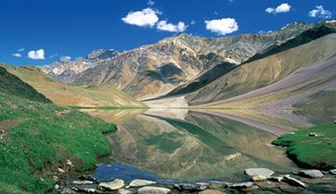
One of the crescent shaped lakes that is located in the middle of the Spiti Valley on the Samudra Tapu plateau, the Chandra Tal, which means ‘Lake of the Moon’, is a popular destination for trekkers and climbers. It is confined in between the mountains at a lofty height of 4,250 meters and is one of two high-altitude wetlands of India which have been designated as Ramsar sites. The Chandra Tal Trek grabs the imagination of the travellers with its rambling landscape at different altitude. The lake encircles a vast meadow that is carpeted with different kinds of wildflowers. One of the easy to moderate treks in Himachal Pradesh and also a short trek from Manali, which is a popular hill station at an altitude of 2,050 meters, the Chandra Tal Trek solicits the mind of travellers with the abundant beauty of nature and wildlife.
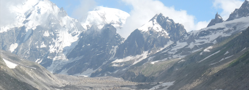
The Chandra Tal Trek commences from Manali and leads to Chikka, which is at an altitude of 3,100 meters, via Sethan at 2,900 meters. The trail then winds up at Balu Ka Gera at 3,600 meters before further continuing to Shira Gorh after a steep ascend towards Hampta Pass, which is at an elevation of 4,268 meters. From Shira Gorh the trail snakes through the deserted track to Batal via Chatru wherefrom the track splits to Kunzum at an altitude of 4,551 meters, which is the gateway to Chandra Tal. The trail continues to Tokpo Gongma and snakes up to Baralacha La, which is at an altitude of 4,890 meters. From there the trail leads to Manali en route to Keylong, which is approximately a 4 – 5 hours drive.
The Chandra Tal Lake Trek is an absolute bliss for amateur trekkers and the best time to hit the tracks is from Mid June to Mid October. From Manali the trail is approximately of 7-8 days.
Chandratal Lake Trekking Tour Highlights
- Mesmerizing Chandertal Lake
- Brilliant landscape
- Trek via Hampta Pass
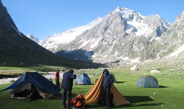
- Amazing sites for camping
- Verdant valleys and forests
Best Time to Visit Chandratal Trek
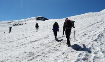
Best season to visit Chandratal Trek is from mid-June till mid-October. In the beginning of the season, there are more chances of seeing lots of snow. Snow cover reduces considerably as August approaches. As the season advances, we are more likely to witness rain in the Kullu Manali Valley and bask in the sun at the Spiti Valley.
The days are warm and sunny with temperatures ranging from 12 to 20°C, and nights at the highest campsite fall in between -2 to 6°C. In the last phase of the season (Sept to mid-Oct), the amount of snow in the path will dwindle. General weather conditions will be good and sunny, but with October approaching there is a chance of snowfall. The day temperatures float between 12 to 18°C; while the night’s hover around -6 to 4°C.
Where is the Chandratal Trek
Chandra Tal (‘the Lake of Moon) is located at the height of 4,270 metres in the Himalayas. It comes under the Spiti area of Lahaul and Spiti district of Himachal Pradesh. Chandra Tal is a popular trekking and camping destination, attracting a number of travellers every year. It can be reached on foot from Batal as well as from Kunzum La Pass. The best season to embark on the Chandratal Trek is from mid-June to mid-October. There is a 16 km motorable road from Batal which can be accessed after mid-July, as the condition of the road can be dangerous before this period. Even after taking this road, one needs to walk for 2 km from the road head.
Trail which begins from Kunzum is truly picturesque and displays panoramic views of Samudra Tapu Glacier, CB Peaks and Chandra River. It is 8 km long and takes only 4 hours to complete. Chandratal Lake is just at a walking distance from Kunzum. The source which feeds the lake is probably under the ground, as there is nothing visible on the surface. Wild flowers fill up the banks of the lake in summer. The vast green meadows around the lake are a favourite among the Gaddi Shepherds, who come here to graze their flocks. The shepherds of Gaddi tribe enjoy their traditional and long held grazing rights in the area. Chandratal Lake is one of the two high altitude wetlands of India.
How to Reach Chandratal Trek?
Nearest Airport:The Kullu Manali airport at Bhuntar Town (about 50 km south of Manali and 10 km south of Kullu town) is the nearest airport. Indian Airlines and some private airlines have regular flights to the airport (But due to bad visibility most of the time flight cancelled). Chandigarh airport is the nearest international airport.
Nearest Railway Station:Jogindar Nagar is the nearest railway station (lies 166 km from Manali). The other convenient rail heads are at Chandigarh and Pathankot.
By Road:Manali is well connected by road with Delhi, Ambala, Chandigarh, Dehradun, Haridwar, Shimla, Dharamsala and Chamba/Dalhousie. Regular buses ply between these stations. It is connected with Leh during July to October.
Chandratal Trek (Detailed Itinerary)
Day 01: Delhi – Manali
In the evening drive to Manali by AC Volvo coach at 18:30 hrs. Overnight journey.
Day 02: Manali
Arrival at Manali by morning. On arrival transfer to hotel for relax. In the afternoon visit Hadimba Devi temple. Evening free to explore the Mall road. Overnight stay at hotel.
Day 03: Manali – Preeni – Setan
We headed to the village of Preeni from where we commence our trip towards the scenic village of Setan. Camp site located outside the village.
Day 04: Setan – Chikka
We start early and after crossing a couple streams we go on a stone strewn path towards our next camp site. We will camp on a widespread meadow.
Day 05: Chikka – Balu Ka Ghera
Today the hike is steep and can be exhausting as we move towards the base of the Hampta Pass and reach our campsite on a sandy strip adjacent to a mountain stream. We will stay in the camp overnight.
Day 06: Over Hampta Pass (4270 Metres) – Chatru
The hike to the pass is yet again a steep one and once on the Hampta pass you get to see the fabulous views of the northern mountain crests of Lahaul and Spiti. By Late evening we reach the small roadside camp of Chatru.
Day 07: Chatru – Chota Dara
Today the trail is along the Spiti highway. Our next stop in the travel is another road side arrangement of the Chota Dara. There is an old Rest house and a seasonal tea shop here. Camp close by.
Day 08: Chota Dara – Batal
Today we will continue our trip along the road and strolling along the River Chandra to reach the next little modest settlement and temporary tea stall and Dhabha at Batal. Camp site near the makeshift stall on the lush green plain on the banks of the River Chandra.
Day 09: Batal – Chandratal
A little bit ahead of the tea stall there is an uneven track leading towards the north. While the highway proceeds to the Kunzum Pass and on to the Spiti, this thoroughfare leads to the gorgeous mountain lake. Far away below you can see the silvery River Chandra meandering in the direction of Lahaul. By early evening we reach the lake. The camp is located on the shoreline of this enchanting lake.
Day 10: Chandratal
Rest day in Chandratal as the body needs have a recoup. All around this crystal clear and beautiful water body there are magnificent views of soaring deserted mountains. The camp site is located near to the shores of the Lake.
Day 11: Chandratal – Manali
In the morning after breakfast drive to Manali via 2 high passes Kunzum La and Rohtang La. On arrival at Manali check in to hotel. Our outdoor team will leave the troop here with warm wishes and with hopes to many more, visit time and again for more trekking and exploring the incredible Himalayas.
Day 12: Manali and Delhi
In the morning explore the surrounding. You visit in another place in Manali and we are having lunch together in hotel evening 4:30 drive to Delhi by AC Volvo coach. You have your overnight journey.
Day 13: Delhi
Arrival at Delhi by morning.
Tour & Services End.
Things to Carry for Friendship Peak Trek
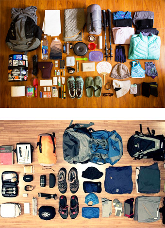
- Duffel bag Down/synthetic camp booties
- Sunglasses, Light gloves
- Sleeping bag
- Flashlight/Headlamp with extra batteries
- Daypack
- One liter water bottles wide mouthed
- Trekking Boots
- Water purification/filter
- Camp shoes/sneakers
- Walking stick/Trekking pole
- Cotton socks
- Note book with pens and pencils
- Gore-Tex jacket
- Lip balm
- Light wind jacket Sunscreen / Moisturiser
- Down jacket/vest
- Camp towel/towel/sarong
- Fleece jacket/vest
- Personal toiletries
- T-shirts
- Personal medicines
- Underwear
- Money pouch/belt
- Trekking pants
- Energy bars
- Thermal tops
- Vitamin tablets
- Thermal bottom
- Extra passport photos
- Warm hat and Bandana/scarf
- Sun hat/baseball cap
- Wind- and rain-gear with hood
- Swiss Army Knives (Classic pocket tool)
- One pair cotton trousers or shorts
- Two cotton shirts/T-Shirts One warmer (jacket with hood)

